OMAN
“Improving early warning and early action systems to reduce disaster risk.”

OMAN
2014 – 2019
Development of a working methodology and risk assessment framework for multiple coastal hazards along the coast of Oman and application of this assessment to hazards such as tsunamis and meteorological tides.
The hazard, vulnerability and risk assessment was conducted at two different scales: national (along the entire coast of Oman) and local (in 9 selected study areas: Sohar, Wudam, Sawadi, Muscat, Quriyat, South, Masirah, Al Duqm and Salalah).

OMAN
2014 – 2019
-
Development of a working methodology and risk assessment framework for multiple coastal hazards along the coast of Oman and application of this assessment to hazards such as tsunamis and meteorological tides.
The hazard, vulnerability and risk assessment was conducted at two different scales: national (along the entire coast of Oman) and local (in 9 selected study areas: Sohar, Wudam, Sawadi, Muscat, Quriyat, South, Masirah, Al Duqm and Salalah).

CONTEXT
-
- REGION, COUNTRY: Oman
- CLIENT: DGMet – Directorate of Meteorology
- SOURCE OF FUNDING: DGMet – Directorate of Meteorology.
- SCOPE: International

WHAT HAS MADE THIS PROJECT UNIQUE?
-
- Supporting evidence-based decision making and innovation for contribution to the SDGs.
- Design of multidisciplinary, integrated and unique solutions to address the complexity of socio-ecological systems associated with water and ensure their resilience.
- Capacity building and knowledge transfer to new generations of professionals (research and management personnel) to promote the progress of science and society.
- Cooperation, alliances and partnerships for sustainability, as an interface between academic and business, local and global, public and private agents.

HOW HAS IT ALIGNED WITH OUR MISSION AND VISION?
-
- Provision of sustainable innovative solutions based on scientific excellence.
- Development of technical tools and procedures that facilitate decision making on planning and integrated management of social-ecological systems.
- Knowledge and technology transfer.
- Multidisciplinary and collaborative approach.

WHAT LESSONS HAVE BEEN LEARNED?
-
- ArcGIS Server has enabled the creation of interoperable WMS, WCS and WPS services to facilitate access by third parties, in this case the Decision Support System (DSS) for tsunami early warning designed by UNESCO (United Nations) for the Indian Ocean.
- The knowledge acquired through scientific developments and consultancy work allows us to design software specially adapted to specific clientele.

WHAT HAS BEEN THE IMPACT OF THE PROJECT?
-
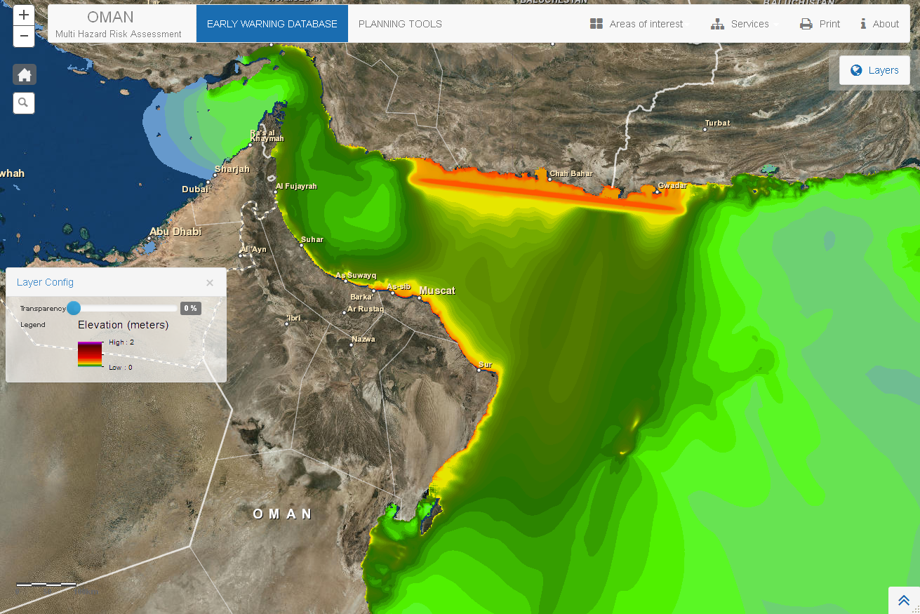
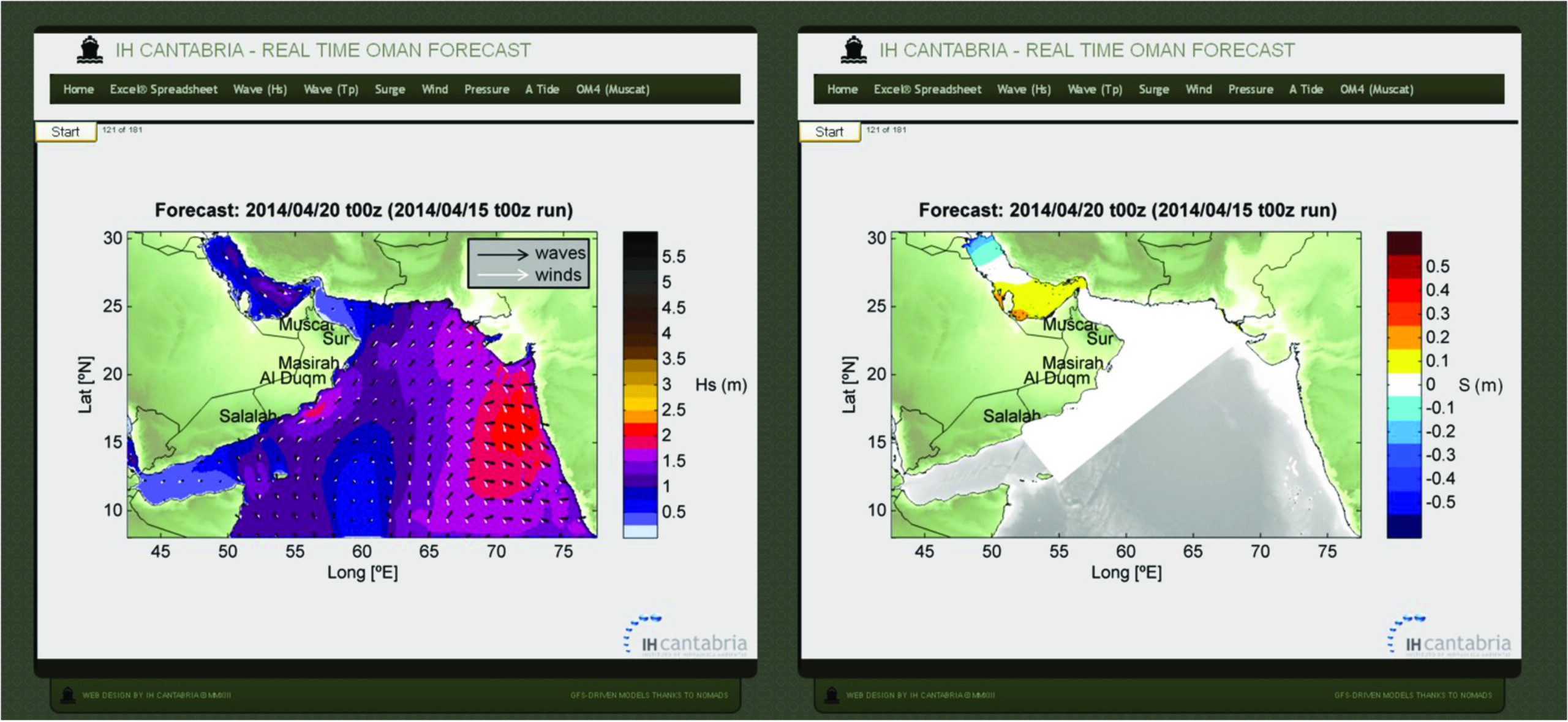
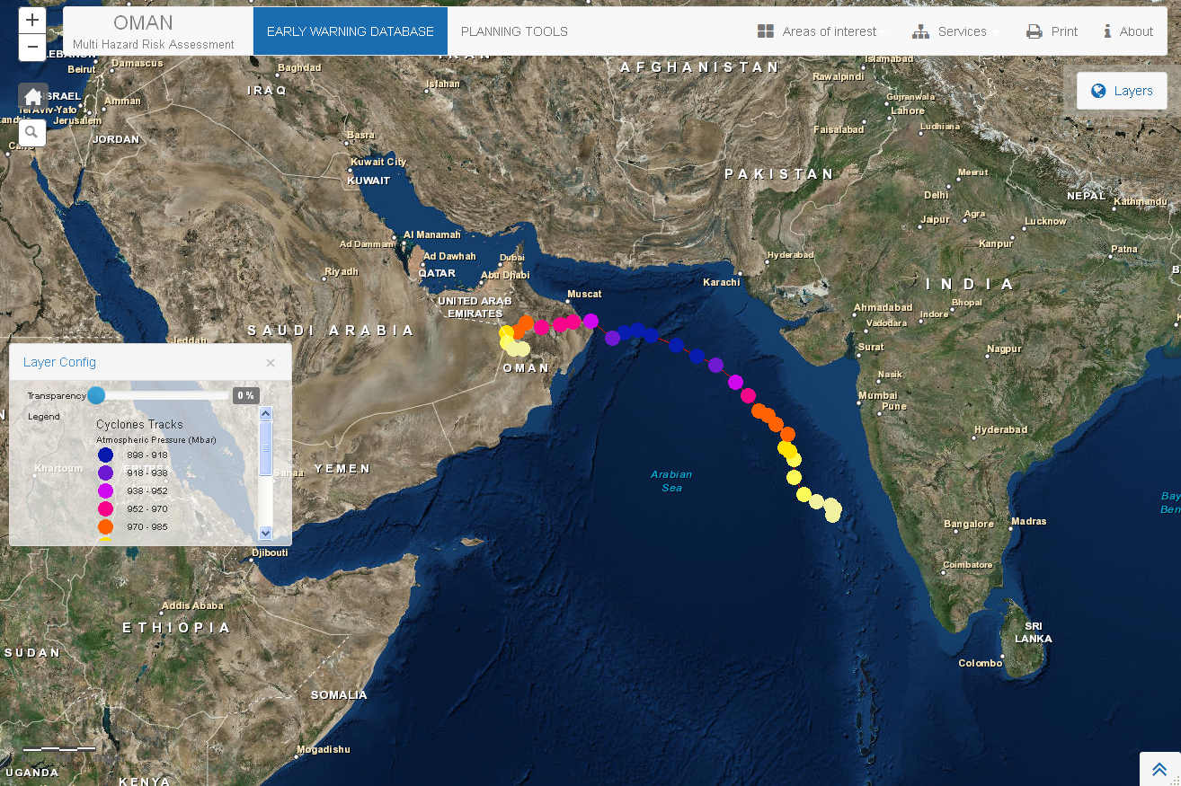
- The Multi-Hazard Hazard Assessment System (MHRAS) was implemented in the National Multi-Hazard Early Warning System (NMHEWS) which requires real-time forecasting to estimate the consequences of a potential hazard affecting Oman’s coastline and improve response capability.
- MHRAS has been materialized in a website based on GIS (Geographic Information System) technology, and consists of two parts: on the one hand, the Planning Tools section, which shows the results of hazard, vulnerability and risk assessment, complementing the Hazard, Vulnerability and Risk Atlas; and on the other hand, the Early Warning Database.
- Publications: Tsunami Hazard, Vulnerability and Risk Atlas and Risk Reduction Measures Handbook.

WHY HAS IT BEEN SUCH A SUCCESS?
-
- Design and development of a Multi-Hazard Early Warning System.
- Development of a flood risk mitigation atlas for the Omani coast: GIS operational system for data management and integration.
- Development of the Multi-Hazard Hazard Assessment System (MHRAS), a support system for tsunami and tropical cyclone planning and early warning for the Oman coast. The development has required the simulation of more than 3500 tsunamis and tropical cyclones, which have provided the inundation, vulnerability and risk of Oman’s coastal zone.
CONTEXT
WHAT HAS MADE THIS PROJECT UNIQUE?
HOW HAS IT ALIGNED WITH OUR MISSION AND VISION?
WHAT LESSONS HAVE BEEN LEARNED?
WHAT HAS BEEN THE IMPACT OF THE PROJECT?
WHY HAS IT BEEN SUCH A SUCCESS?
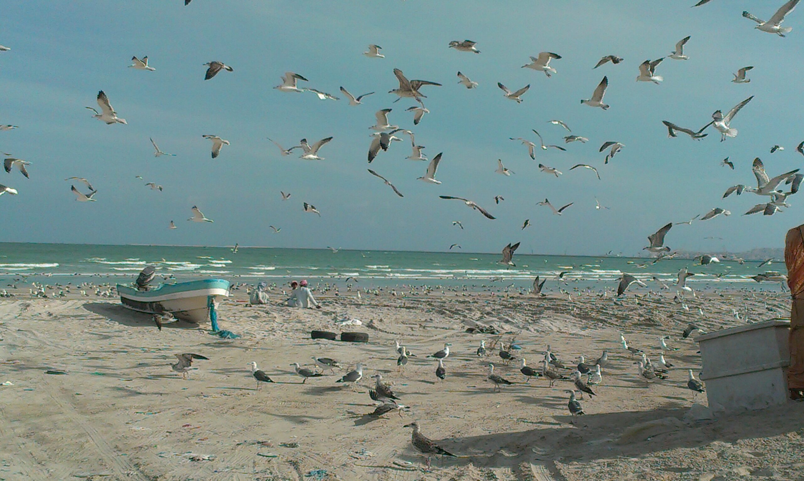
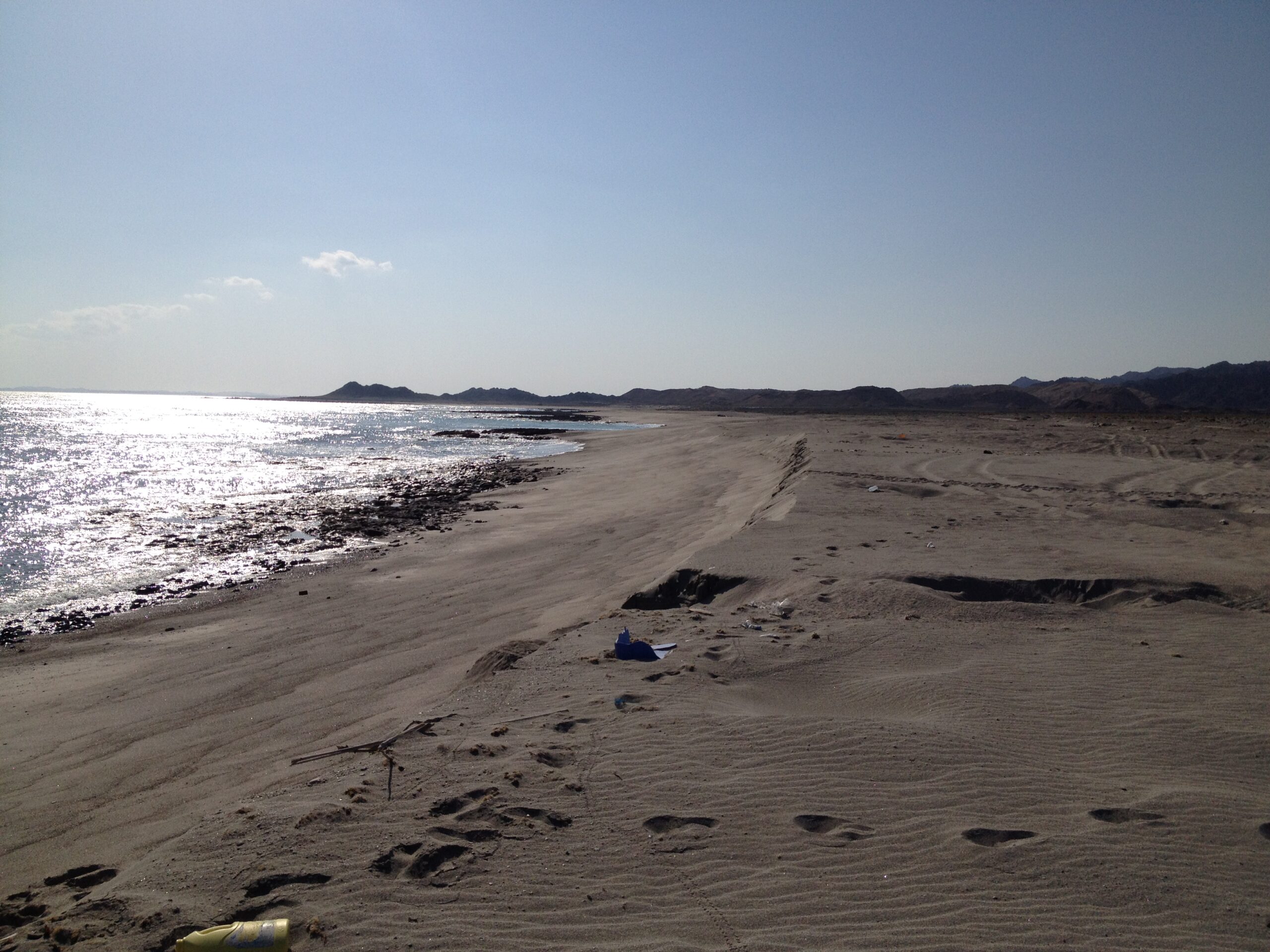
GALLERY


PARTICIPATING ENTITIES
HMR – Environmental Engineering Consultants (Oman)
PARTICIPATING ENTITIES
– HMR – Environmental Engineering Consultants (Oman)